
1.BREIF
The target users I chose in this project are Skiers and mountain sports enthusiasts-smartphone users

According to Wikipedia, I divided the target users of this project into the following:
1.Sking users
2.mountaineering users
3.hiking users
4.camping users
5.mountain bike users

2.PACT ANALYSIS


PEOPLE:
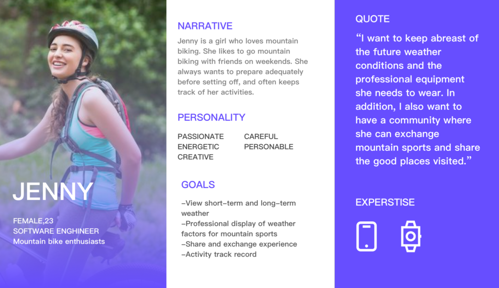
The target users of this application are skiing and mountain sports enthusiasts. Based on this type of users, we can focus on their needs, such as nearby places suitable for activities, and weather reminders based on personal preferences. Consider that their hobby is extreme sports, so their activities are located in snowy mountains, peaks, etc., so the user’s personal safety factors need to be considered. Social communities can be established, and users can mark or rate each activity location.
ACTIVITIES:
The application is mainly used for people to check the weather before and during the event, and to check the action track and share after the event. Therefore, the weather function can be divided into the real-time, short-term forecast, 1-3 days of recent weather, 4-6 days of long-term weather, and 15-day ultra-long weather. User-based activities are divided into three steps: plan, implement and review. Therefore, in the early stage, the app should help users plan their itineraries and remind users of the equipment and clothes they need to bring. In the mid-term, this app should provide assistance based on the user’s itinerary and personal safety. For example, when the user encounters extreme weather such as blizzards, rainstorms, or geological disasters, the user should be reminded in time.
CONTEXT.
Considering that the user’s attention needs to be focused on the activity when doing outdoor sports, considering the user’s safety issue, the app needs to be more convenient and faster to interact during the user’s exercise. You can refer to some maps and music apps, they will turn on the driving mode when the user is driving, making the interface extremely concise. In addition, Baidu Maps is also equipped with a voice assistant, which can be used to wake up the assistant to achieve the purpose of interaction.
TECHNOLOGIES:
Considering that users need to focus on activities when they are doing outdoor sports, the app can be adapted to wearable devices in consideration of the user’s safety issues, so that users can more easily see the content and information of the app.
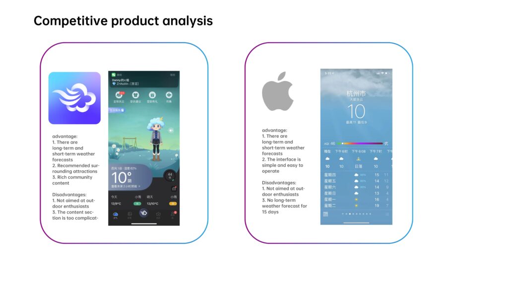
3.COMPETITIVE PRODUCT
4.FLOWCHART OF THE APP
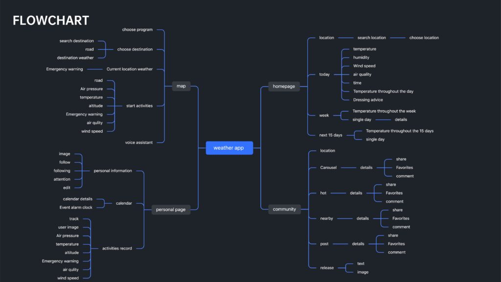
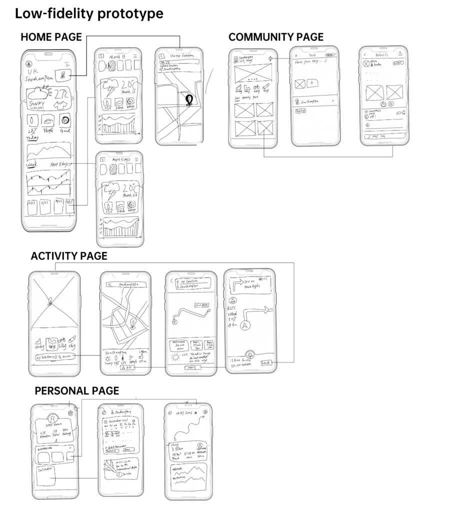
Home page function:
- Show the weather (24 hours / next seven days / next fifteen days)
- Temperature/air pressure/altitude/moderate/air quality/recommend suitable clothing
- Positioning
Map function:
- GPS navigation function: can recommend 3 routes / display arrival time /
- Midway Weather Warning/Destination Weather
- Air pressure/air quality/altitude/temperature/humidity on the way
- voice assiment
personal page:
- Route record (view past activities with data on the route during the activity and various weather factors)
- View fans and follow
Community functions:
- Share upload pictures and text
- View popular sections
- Recommended nearby attractions
- Follow others and comment likes
5.PERSONA
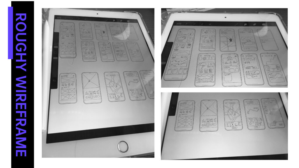
6.ROUGHY WIREFRAME
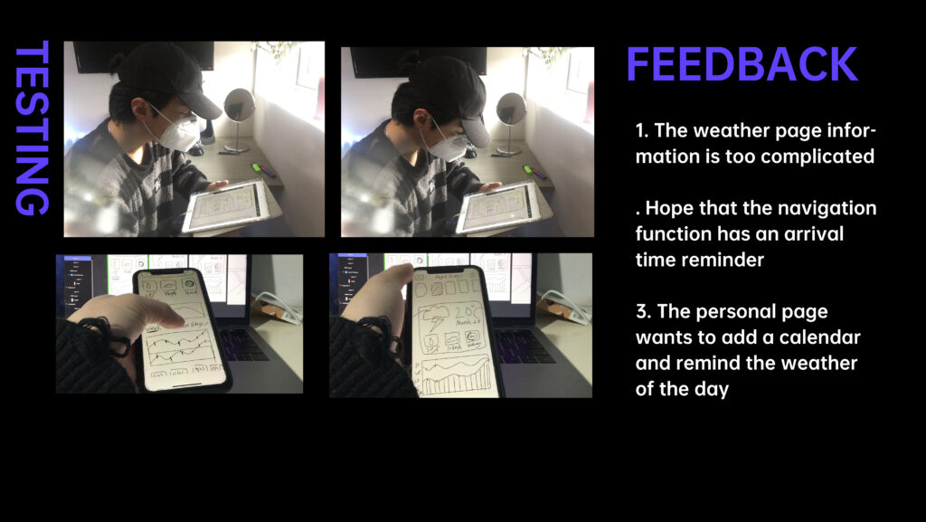
7.PRELIMINARY TEST FEEDBACK
8.Detailed prototype and function upgrade
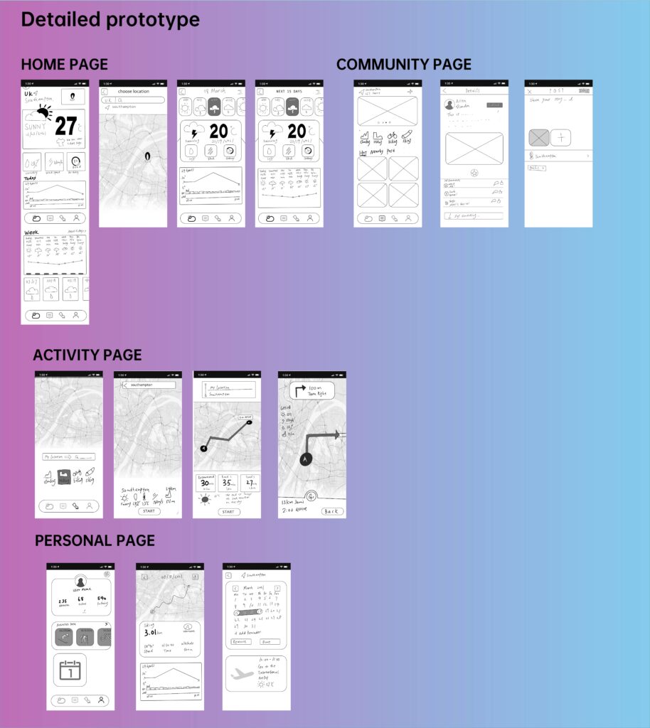
Based on prototype testing and user feedback, I added the following functions:
- Add altitude function and dangerous area reminder to the homepage
- The wind speed function is added to the map function, because the wind speed resistance is often considered in mountain sports
- Add calendar function to personal homepage function and reminder of the weather conditions of the day
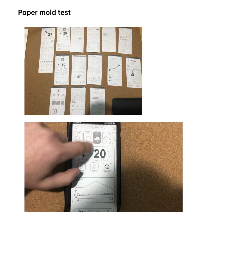
9.PAPER MOLDE TEST